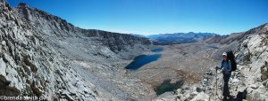
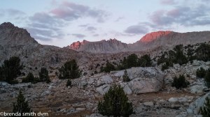
Day 21 ~ Rentry at Onion Valley and the Kearsarge Pass to Kearsarge Lakes
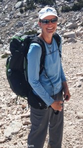
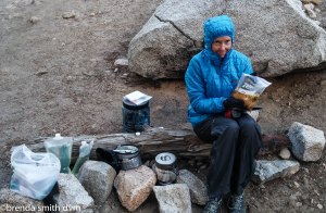
We are up early since the shuttle leaves at 8 am. Showers (which you learn to really enjoy knowing it will be the last hot water for a week or so!) and breakfast. Strider gives a necklace that she makes to all the women hiking, sort of like a protective talisman. Tim knows about Strider and the Lord of the Rings, so it makes sense to him, but regardless of my LOTR knowledge it is a very nice gesture! And pretty necklaces, too! Her dog, Indy, is very nice and excited to ride up to the trail. He gets a quick check by yours truly, and we are off to the trailhead.
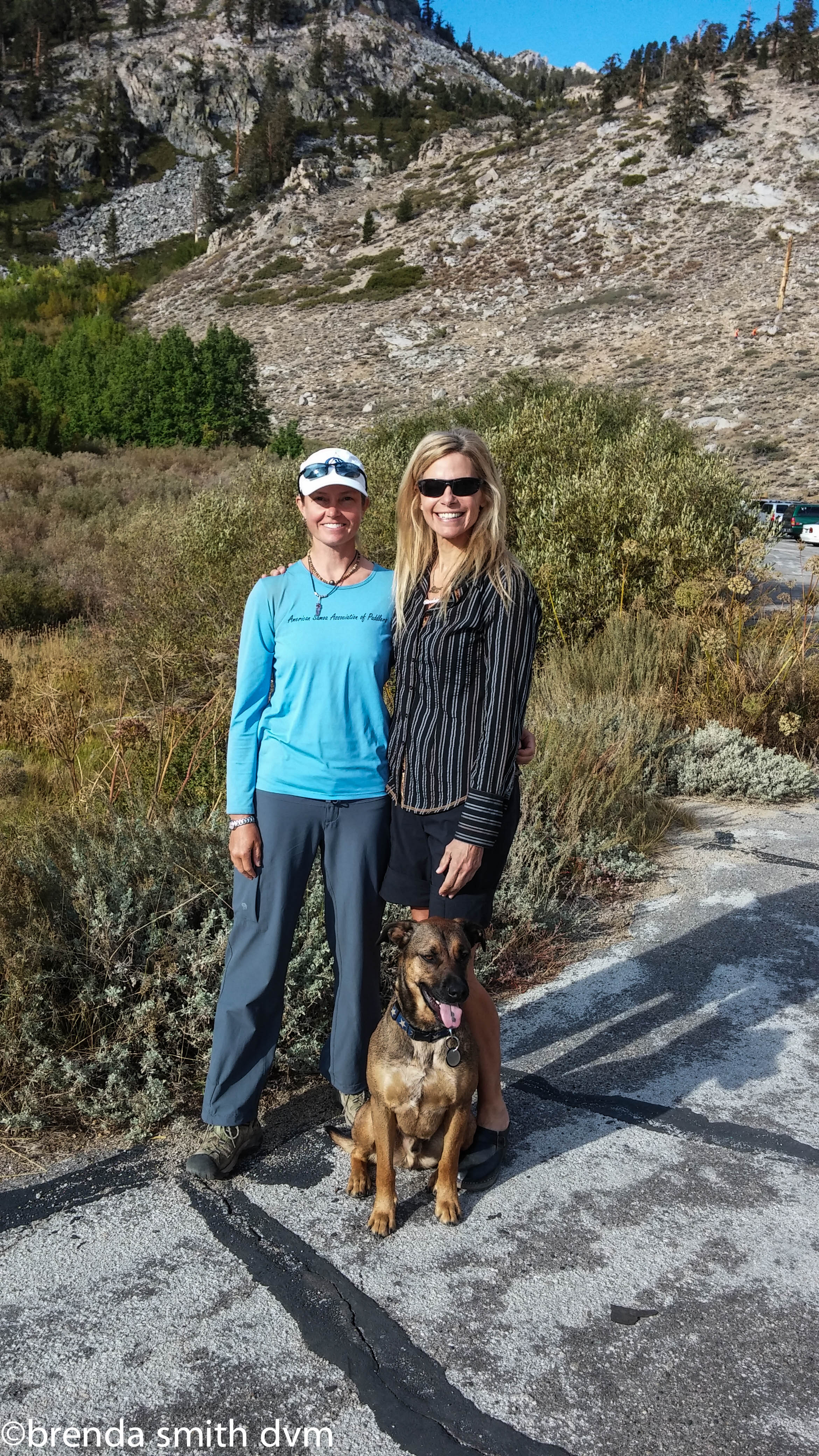
At the trailhead with Strider and her dog, Indy
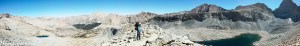
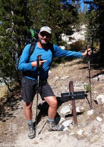
Tim and I have 9 days, and it only takes 4 or so to finish the rest of the JMT, so we ask for recommendations for side trails. Tim asks Strider to help him with the map and compass since she is well known for hiking all these trails. He and I have had a conversation or two about declination (which means he is pointing to what he thinks is north, and I am pointing about 25 degrees to his left using the sun at the equinox as my guide!)… Strider: “Declination? Hmmm. Well, (as she points North) North is that way because that is where my mom lives.” HA HA HA HA!!!! Tim is so frustrated. He just gives up and puts away the compass, knowing it is useless and thinking that girls will always gang up on him. Anyway, Strider gave us her recommendation for where to spend our extra days: Lake South America and the surrounding area. Excellent. And we’re off again, heading up and up for 5 1/2 miles and 2600 feet of elevation gain to 11,845 feet at Kearsarge Pass.
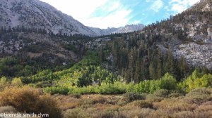
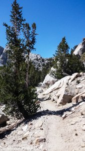
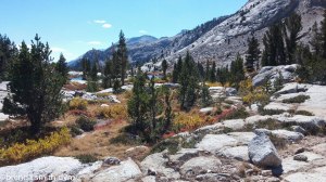
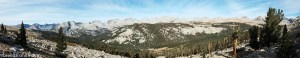
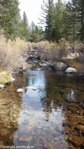
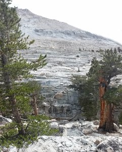
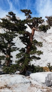
Our walk starts out up a beautiful valley. It is surprisingly green considering how brown the flat Independence area was. We pass two deer hunters sitting on big rocks less than a mile from the trailhead. One has a rifle and one has binoculars. Interesting. Not much of a sport… We continue up the valleys and a series of nice lakes. A few miles up, I start feeling crummy, and by Mattock Lake I have full-on stomach cramps. So we take a break there for an hour or so, until I can get moving again, albeit without much enthusiasm for the uphill miles yet to go. The rest of the day is not very pleasant for me, as I feel empty and weak and there is no way I am eating anything again.
(click any photo for a slideshow)
-
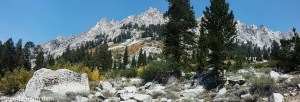
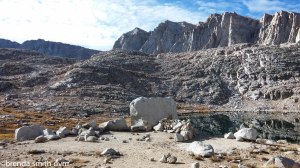
- Onion Valley
-
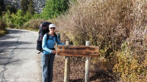
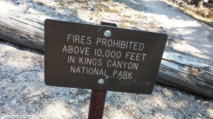
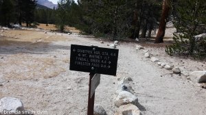
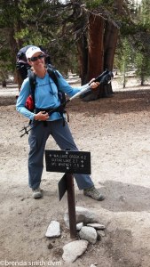
- Trailhead sign
-
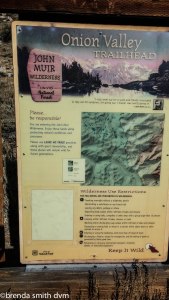
- Trailhead info
-

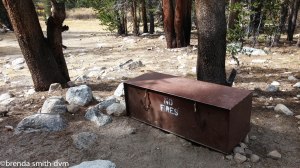
- Smart bears! Thus the heavy bear bins…
-

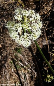
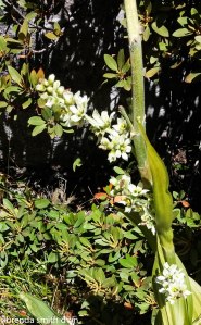
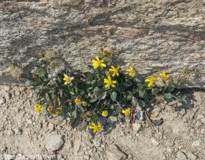
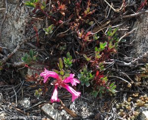
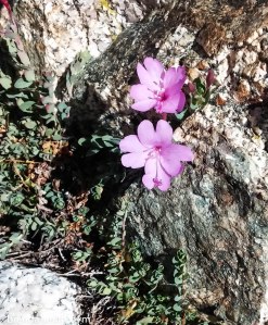
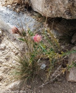
- Indian painbrush
-
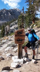
- Into the wilderness!
-
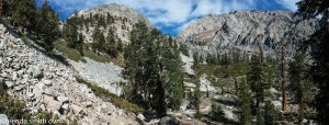
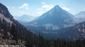
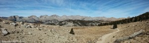
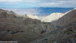
- I think the pass is the notch in the center
-
- Beargrass
-
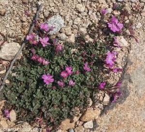
- More wildflowers
-
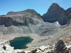
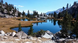
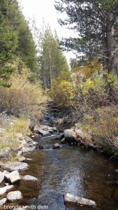
- Mattock Lake
-
- Mattock Lake
-
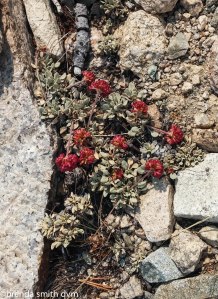
- Wildflowers
-
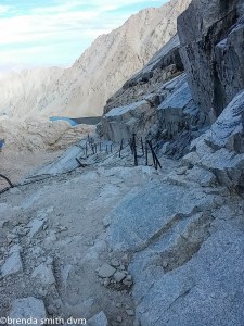
- The trail near the pass
-
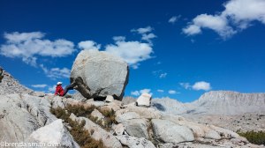
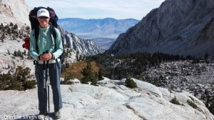
- Tim’s pack fits like a minidress
-
- Tim, my knight in shining armor
-
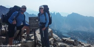
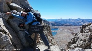
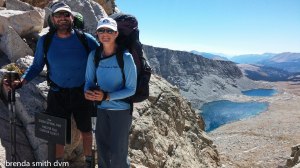
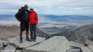
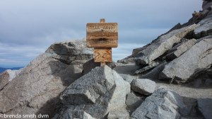
- Summit of Kearsarge Pass
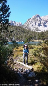
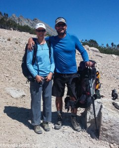
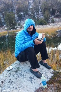
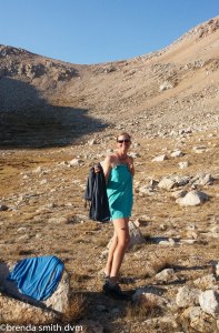
Mike and Andy hopscotch with me as we are nearing the pass. Mike is 75 and hikes Kearsarge Pass once every year. Andy seems to be his grandson. It used to be Mike’s favorite day-hike when he lived in the area, but now he lives in Thousand Oaks and just comes annually. It sounds like he manages to connive a family member into accompanying him each year, as he had stories about an engagement at the top that he witnessed with his niece a year or two before. Tim has gone ahead of me, as it is super hard to walk a pace that is too slow for you (and I am going too slow for anyone to follow!). I’m about 2 big switchbacks from the pass when he reappears coming down to help me ~ trying to be my knight in shining armor! At least a knight with a fairly empty pack. He figured I was still much further down, and was going to carry my stuff up for me. Since it isn’t far, we just switch packs which is hysterical because even though I am not much shorter than he, his pack fits me like a minidress!
We stop to reload Tim’s pack, and chat for a bit with a girl heading down to resupply. She has been doing the PCT since starting at the end of June at Snoqualamie Pass near Seattle. She is hiking with four friends who started at the Canadian border, skipping about 150 miles for smoke from the wildfires in Washington. Her favorite part so far was the wildflowers at Goat Rocks! She asks about hitching from Onion Valley… lamenting about how having guys with her really lessens her ability to get rides! They are planning to go the end of the trail at the Mexican border.
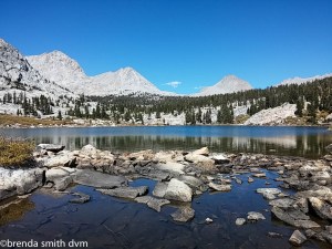
As we (finally) reach the pass, smoke is coming up from the north and the south. We can smell it, see it, and Tim starts to cough as he finds it irritating. We head down the other side of the pass to find a campsite at Kearsarge Lakes. Tim is really tired, and I have to convince him to eat dinner. I fall asleep by 6, and apparently Tim gave me Tums in my sleep. He read for about an hour, and was asleep as well by 7 pm!
(click any photo for a slideshow)
-
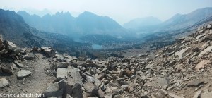
- Smoke over Kearsarge Pass
-
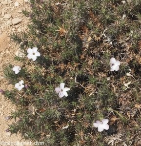
- I’m pretty excited to see flowers
-
- So enjoy the pics
-
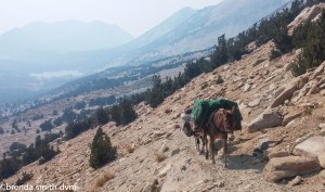
- Mule who escaped the train. But followed.
-
- Tim got tired of me stopping to take flower pics!
-
- So he just walked ahead, ha…
-
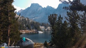
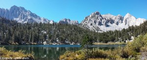
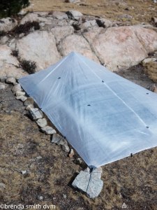
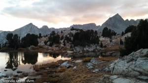
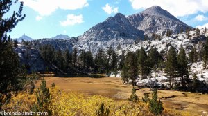
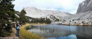
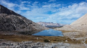
- Our campsite at Kearsarge Lakes
-
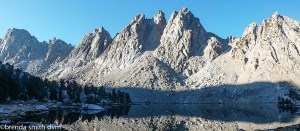
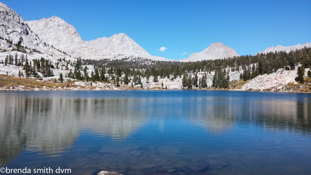
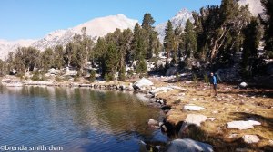
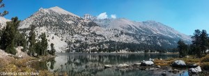
- Kearsarge Lakes
-
- Tim ‘enjoying’ his dinner
-
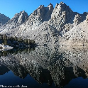
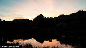
- Kearsarge Lakes reflection
Day 22 ~ Vidette Meadow and Bubbs Creek
The day after being sick is never a good day to hike. We saw a few others who had camped around the Kearsarge Lakes. We tried to meet up with the JMT by shortcutting around the end of the Kearsarge Pinnacles, but I was so dizzy and weak that we had to abort and just take the trail near Bullfrog Lake. I struggled all day, feeling depressed and insecure and near tears. Feeling poorly can make me emotionally fragile I guess. We had a snack at Vidette Creek, and I felt a little better. We keep heading up about 5 more miles to get close to the next pass. The cascading waterfalls are pretty and sound lovely. We did not see a soul on the trail until late in the day – when we met a couple who told us they were unprepared and were going back out. The girl had a huge pack, and was carrying a water bottle and her hat in her hand. She told me she was just so exhausted! We have no idea why they passed a bunch of campsites to go further down so late in the day, but maybe they just wanted to be at a lower elevation. We set up camp at a heavily used site along the trail. There were waterfalls across the valley. We were treated to lovely pink sky colors at dusk. We could see smoke again to the north, but none further south where we were heading.
(click any photo for a slideshow)
-
- Leaving Kearsarge Lakes
-
- Bullfrog Lake
-
- Glacier-carved meadows with smoke
-
- Autumn colors in the aspens
-
- We’ve entered King’s Canyon
-

- Waterfall along Bubb’s Creek
-
- Valley view to the north from our campsite
-
- Dinner preparation. Note the stove and bear bin!
-

- Tim enjoying dinner. Our next pass is almost directly above him.
Day 23 ~ Forester Pass
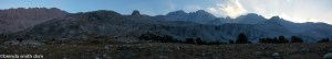
Sunrise gave pretty pink color to the mountains. Tim hadn’t slept well, so was crashed until around 8. He thinks we’ll find 3 more tent stakes before we are finished with our trip, so he searches for one that I had seen but been unable to pull out the day before. Two hikers passed our camp before we were packed up. One was a red-haired girl that we had seen several times around the Thousand Island Lake area two weeks previously. Once we are up and walking, we see a lake only a short distance up where we could have camped instead! Oh well, not much to do if it is too small to make the map. We start our climb up the pass: Forester Pass at 13,180 feet which will be our highest so far. Luckily I am feeling much better today. As we walk, we realize that the flat mesa-type area we were looking at the night before is actually the trail to the pass… yikes! We find beautiful alpine lakes and very interesting and colorful veins in the cliffs. About a zillion switchbacks provide stunning views and we can see and hear pikas everywhere. We can still see a bit of smoke to the north, and are very glad that we made the decision to skip the fire area. The tops of the peaks are stunning and colorful above the glacial valley.
As we near the summit of the pass, we see 2 women headed down. Then right after us to the top are 2 girls (Sarah and Aya from Seattle and LA) who are doing the JMT. They shared an interesting story of how many friends they started with, split up with, added on with, and now are just back to the 2 again. As we started to descend, two brothers were approaching from the south. They were in their 60s and both were sporting knee braces of varying complexity. Funny how we see few people on a trail all day, then a small crowd hits the pass around the same time.
(click any photo for a slideshow)
-
- Sunrise
-
- Our camp was in the trees below the lake. Our pass is left of center.
-
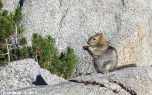
- Chipmunk!
-
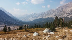
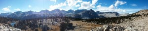
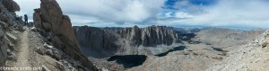
- View to the east and north near Forester Pass
-
- Alpine lake view near Forester Pass
-
- Atop the pass, finally.
-
- Forester Pass, looking south
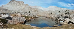
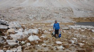
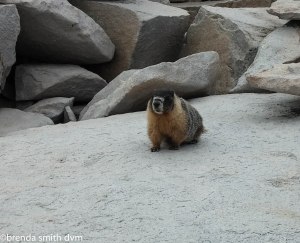
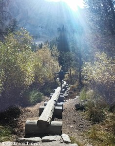
Heading down the south side of the pass, the trail work is amazing. Basically, the trail has been built out of broken up boulders, complete with retaining areas and bridges and huge metal stakes to hold it in place. The top section was exposed and vertical enough to be scary! The whole horse-falling-off-a-cliff thing has done nothing good for my comfort level with heights. (But that is a story I’ll write down some other time…) The valley is quite barren but has nice big lakes. We stop at the base to filter water and have a snack. There is a very sleepy marmot who let me take some close pics without caring at all. (And also without begging for food, so at least that is good. Hopefully I’m just sneaky and he isn’t that tame!) We headed down along a creek, then headed cross-country towards Lake South America. Tim says: “watch out for the holes full of rocks”. Which seems silly until you realize that there are actually big holes all over the place that are full of rocks and small boulders. It is a drainage or flood plain of sorts, and pretty odd. We came to a scree field and could see the trail up to Lake SA across a series of cliffs. Since there was a lake at the bottom and it was getting late, we set up camp at the lower lake. The sun was still warm and we had nice baths in the lake (Tim) or by the lake (me). As we were setting up camp, two guys headed down and reported that the area above was stunning! They had been climbing a few peaks in the area and were hiking back out.
(click any photo for a slideshow)
-
- Heading south down Forester pass. Our destination for the night is to the right over the ridge.
-

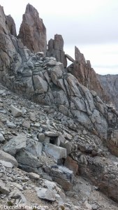
- Trail work. Scary that you just walked there…
-
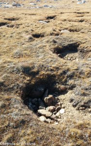
- Random holes with rocks
-
- Holes with lots of rocks
-
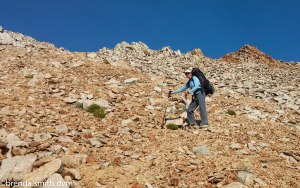
- Scree hill
-

- Tim at the campsite
-
- Time for bathing and laundry. Tomorrow’s trail is directly behind me. Looks close, but there are actually 2 people standing on the ridge in the picture!
We enjoyed nice sunset colors once more, then snuggled into our bags to plan our route for the following days. Thinking about the day and the hiking, I realized that I had been strong all day but at the same time had been zoning out and having tunnel vision most of the day. I think it is from the elevation. It is a very weird feeling! Tim doesn’t experience anything like it, and feels strong and normal all the time. Huh.
Day 24 ~ Lake South America
HOW-WOOOOOOoooo. Midnight or so, a coyote wakes us both us. He is loud and very close. Tim says he continued yipping for a long time. I fell back to sleep, obviously not very worried about the presence of one or a few of the beasts nearby. I actually wasn’t sure if it was real or a dream until morning when Tim mentioned it!
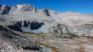
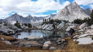
Up a steep hill to Lake South America. Guess what? It is shaped like South America. Go figure. Tim wanted to explore high in the canyon, I was content to explore more by the lower lakes. I still feel a bit of altitude drunkenness. We both started out the day feeling melancholy, like this was our last day of really pretty scenery and then we had to head back to the barren valley trail, blech, but the day turned out to be really nice. It seemed like just by talking about it, voicing why we were feeling blah, and then realizing how nice the area was helped us to recover.
We found a lake with trees, deer, squirrels, chipmunks, and lots of meadowlarks for our campsite. We found tent stake #2 of Tim’s 3 in camp. The sunset was amazing with beautiful colors, reflections of the mountains in the lake, and the risen moon. We felt like all was well. We saw NO people all day. We love our campsite, and plan to leave it as base camp for the next day to explore the lake valleys nearby.
(click any photo for a slideshow)
-

- Kings Kern Divide
-
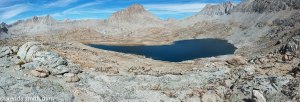
- Lake South America
-
- High lake and Kings Kern Divide
-
- Mt Genevra
-
- Sunset from camp
-
- Sunset and moon
-
- Sunset over the lake
Day 25 ~ Lakes and Valleys of the Kings Kearn Divide
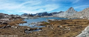
Hiking without a pack is AWESOME!! I can jump between rocks again! We battened down our tarp before leaving in case of a storm, and Tim is carrying water and snacks and first aid and such for both of us. We hike in the valley and around the lakes below Mt Jordan and Mt Genevra. There are heavy clouds in the morning, but it is a nice chilly day for wandering and exploring the area which is SPECTACULAR!! We have autumn colors in the trees and brush, and nice rocks of all different colors. It was a good almost-rest day of walking and snacking and goofing off a bit.
All the resupply stops end up with bins of donated food, and Tim had traded in a few of the things he was getting tired of eating for things in the bins at Mt Williamson. He tried two today: a commercial breakfast scramble from Cascade Ultra Fuel and a homemade lasagne. He approved of both, and was happy for a different meal!
We saw zero people all day, and took time to enjoy the sun and the views. We passed by several large den areas (probably for marmots) and saw and heard lots of birds, chipmunks, and squirrels. And yes, much to Tim’s dismay (and humor), I still say ‘squirr-rel’ every time I see them!
(click any photo for a slideshow)
-
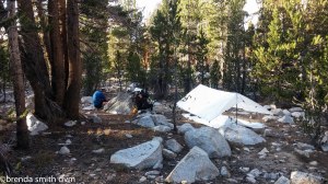
- Tim at the tarp
-
- Battened down for the day
-
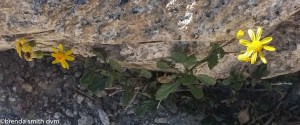
- Wildflowers
-
- Marmot den
-
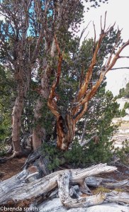
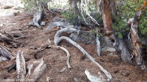
- Gnarly tree
-
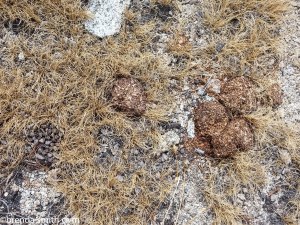
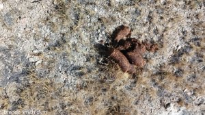
- Bear scat
-
- Another amazing lake ~ Mt Jordan and Mt Genevra
-

- Lake with Mt Genevra and Ericsson Crags
-
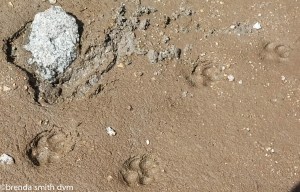
- Coyote footprints
-

- Looking south towards the Kern Valley
-

- The high valleys have lakes, but little vegetation
-
- Having a little fun!
-
- Maybe it will go this way?
-
- Sunset back at camp
Day 26 ~ Lake So America Loop to Tyndall Creek
7am. Brenda: “Look at the sky! Pretty colors!”
Tim: “It looks stormy.” Head back under the quilt.
So we got a late start around 11:30. We had a beautiful walk down the lake valleys. The weather had cleared to nice blue sky. We had planned to move camp to a lower lake and explore another canyon and lake system, but about 2 hours into our walk Tim realized the date. We added up the miles and decided that we really needed to start making our way towards Mt Whitney. So down, up, down, up, and looking for the lowest lake where we could meet up with the trail. We found the loop trail and — Eric! He is from LA and was hiking the loop with a really empty, small pack. We were too surprised to see him to think to ask how, since we are at least 3 days from any town.
Up the loop trail we went, through a gnarled tree forest to rejoin the JMT/PCT. We saw another camper at a site near some bear bins, and then — Eric again! This time Tim stopped to talk to him and found that he had stashed all his gear in the bear bins and was just day-hiking the loop, thus the small pack. We continued along a pretty boring trail area, especially when compared to the back canyon we had just left. Up the hillside and into the trees, and we came to a nice creek. We found a lovely campsite at Tyndall Creek Lakes. It is a huge camp, with many obviously used sites, but we were the only ones there. Probably the smoke and fires have scared off many hikers, so though we are sad about the fires… we are happy for the quiet and privacy! Across the lake in a meadow were four deer grazing, and we were once again treated to lovely sunset colors.
-
- More flowers
-
- More scat
-
- Woodpecker holes (we think!)
-
- Upper Kern Valley
-
- Lake at the Cut-off Trail junction. Nameless!!
-
- Finding the trail…
-
- Beautiful calm day
-
- Grasses by the lake
-
- The Great Western Divide
-
- Our campsite by Tyndall Creek
-

- Upper Tyndall Creek Lake
Our itinerary for tomorrow: Approximately 10 miles. Set up camp before the switchbacks, then summit Whitney the following day. Though we are both sad that this trip is nearing completion, we (mostly Tim) are excited to summit Mt Whitney. We are getting along famously for two people who have actually only been spending time together for a few months, and are looking forward to planning our next trip!
Day 27 ~ Tyndall Creek to Guitar Lake
Tim (while eating another breakfast of oatmeal and contemplating the deer across the lake): “Do you think deer get cold?”
Brenda: “That’s why they have deer sleeping areas to snuggle in the long grass or pine needles.”
Tim: “So in the morning, the baby deer are told ‘get up, time to graze’?
Brenda: “Maybe they warm up when they get their rumens going.”
Tim (with a frown): “Vet jokes.”
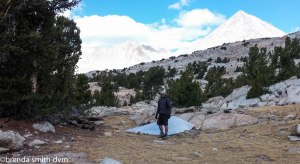
I left early to get started on our 10 mile day. Tim is much stronger than I am now, and walks a lot faster, so I let him take over the task of filtering water at all our breaks. Not too exciting for him, but more efficient use of our time. The filter is leaking horribly now, so takes even longer than it should… So we did that all day, taking breaks together but walking separately. Oddly, whenever I walk by myself, I find my mind wandering to my late husband and our marriage and wonder if I need to write a book to get it all down and out of my head. Regardless, the last few miles Tim and I walked together. We met 2 guys hiking the High Sierra Trail. One likes to make all his own lightweight backpacking gear – tarps and quilts and even slippers! They have hiked in the Sierras together for years, but stick to the trails after one outing when they tried to explore… and I guess must have had some mishaps! This day they had day-hiked Mt Whitney and were headed back down to their base camp. We saw no other people until we set up camp at Guitar Lake, where there were 4 girls resting along the shore. A few more passed by a bit later but continued on.
Guitar Lake is heavily used, so Tim got water from the creek above. He is actually tired for once! We had a lot of elevation change up and down all day, and all above 10,000 feet. Much of it was valley miles, and the area is quite stark. When we did see a few trees, like at Timberline Lake, we were pretty stoked at the beauty! Guitar Lake is at 11,400 ft, and is all rock and water. Since we are so high, Mt Whitney doesn’t look so huge. Or what we think is Mt Whitney doesn’t look so huge….
We have beautiful rocks and cliffs all around. We can see our path for tomorrow: around a corner, up to the pass along a LOT of switchbacks, and along the ridge to the summit. It is nice out, and this is actually the first day I’ve been able to write notes without climbing into my sleeping bag first to stay warm. After a dinner of instant mashed potatoes, dehydrated veggies, and dehydrated refried beans… off to sleep!
-
- Kern Valley and Great Western Divide
-
- Up to the BIghorn Plateau
-
- Bighorn Plateau
-
- Our first sign with Mt Whitney!
-
- Wright Creek
-
- Bear lockers!
-
- Headed to Guitar Lake
-
- Wallace Creek
-
- Mt Young
-
- Timberline Lake
-
- Spiny wildflowers
-
- Tim hauling water to our camp along Guitar Lake
-

- Camp at Guitar Lake, Mt Whitney in the background
-

- Lichen
-

- Taking notes in camp
-

- Sunset!
Day 28 ~ Mt Whitney !!
Today is summit day! We have high clouds in the morning, then it is partly cloudy, windy, and cold all day. UP and UP the switchbacks. We saw several people on the way up, going both ways. One fit guy in his 20s had been surfing in San Diego the day before. He was planning to do the JMT in 14 days between finishing his old job and starting his new job. He had a 65 pound pack complete with a gopro helmet cam and a pop-up tent. I wonder how he fared….
At the trail junction (five hours after starting), we left most of our gear. There are lots of left items: poop bags, clothing, and supplies. I want to hope that most people will pick it back up and pack it out like we will… The actual 2 mile trail to the summit is exposed, but fairly easy. It is like a highway compared to our last few weeks ~ we crossed paths with at least 30 people of all ages. It is an interesting assortment. Some people hike it after weeks on the trail, like Tim and me. Others take 3 days and set up a base camp on the Whitney Portal side. Some day-hike it, all 22 miles!
The saddest part is the disrespect that people have for such an amazing place. Tim was poking with his hiking pole at several of the gray bags laying about or tucked under rocks. When I warned him to leave them alone… he hadn’t realized they were all poop! There is no vegetation in the area, so all human waste must be packed out. Gray bags are dispensed, and obviously used, but then people just leave them. There was also a good deal of human urine and even feces in many places along the trail. Seriously people? You are disgusting. We were both amazed, especially since it takes quite a bit of effort to get here.
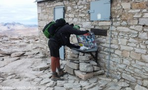
It took about 2 hours to get to the summit. We had several other people, as well as marmots and birds begging for food. It is cold and windy, but the views are spectacular. The cabin has a room to get out of the rain and a summit log. After spending time having a snack and enjoying our views, I got really cold and basically jogged back down the trail until it became too steep. After 45 minutes to get down, I had to put my pack back on (it was so nice to be free of the weight!) and begin the descent to Trail Camp. We passed several others still going up, which was a bit scary since it was already past 3 pm. The worst was a dad with a 5 year old. We were both worried about the little guy, but what can you say?
It was about 2 hours down to Trail Camp. Tim had found a site among the crowd of campers, as we didn’t have enough day left to get further down to a lake as we had hoped. The area is also disgusting, with toilet paper everywhere. I wish there were cameras or some way to fine the heck out of people who can’t seem to clean up after themselves and pack out their waste! OR blacklist them from getting another backcountry permit! (Permits are required to hike in the backcountry or to summit Whitney.) Regardless, after a quick dinner we sacked out.
(click any photo for a slideshow)
-
- Campsite near the rocks
-
- Guitar lake
-
- Trail to the pass
-
- Along the switchbacks
-

- Tim at the trail junction
-

- Along the summit trail – Tim is in the photo!
-

- Mt Whitney hut
-

- At the summit marker
-

- View from the summit to the west
-
- Hooray ~ Mt Whitney!
-

- Overly tame marmot and bird
-
- Marmot
-

- Gray crowned Rosy Finches
-

- Inside the hut
-
- Tim signing the summit log
-

- Beginning the descent ~ brrrr…
-

- The trail is rather exposed in places, sorta freaking me out…
-

- View of the Sierra Nevada
-
- Did I mention that the trail has some exposure?
-
- View to the east
-

- Coming down from the pass
-

- Still smiling : )
-

- Pika!
-
- Not my favorite section either…
-
- A glacier is still partially intact!
Day 29 ~ Whitney Portal
It is our last day. We wake up melancholy – glad to have summited and successfully completed our goals, but sad that the trip is over. It was about a four hour walk down. It is a surprisingly beautiful canyon ~ and we were glad because we had been afraid that it would be brown, boring desert.
We passed quite a few kids with their parents, and wondered if it was some sort of school holiday. Turns out that a lot of the kids in the area are home-schooled, so have flexible schedules. It was a nice hike down with beautiful lakes and rivers.
At the bottom we weighed our packs. Mine was 29 pounds and Tim’s was 35 pounds without any food, so it must have been between 45 and 50 with our 2 full bear bins! To the store we went, for a lovely lunch of burgers (without the burger or bun for me, so basically condiment salad), fries, and ice cream. We hitched into Lone Pine with a lovely couple from Australia who area spending 3 months touring the US National Parks. Then we hitched to Valencia with another nice couple who work at REI and the Apple store in Santa Barbara. Weigh in: Tim lost 10 pounds and I gained 5! I’m sure it is muscle, ha ha… We gorged on Mexican food and margaritas, then passed out! My friend from AmSam (Kerry) is picking us up for a visit the next day, then giving us a ride to the LA airport for the next stage of our vacation ~ visiting family in Boulder and Texas!
(click any photo for a slideshow)
-

- Consultation Lake
-

- Spiny flowers
-
- View of the valley towards Whitney Portal
-
- Interesting pines
-

- With BLUE pinecones !!
-

- wildflowers
-
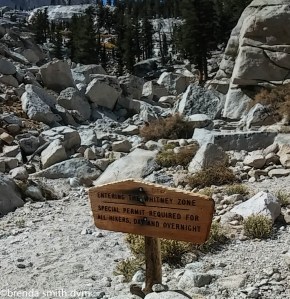
- ‘The Whitney Zone’
-
- Creek crossing
-

- Finished!
-

- Lunch ~ mmmmm, fries…

Brenda, this is amazing, you are amazing. I’ve known you since 1989 and you’ve amazed me each and every step of your life. I dream of living the adventures you actually take. I’m so proud of you and as I read your blog I can hear your voice telling me, your captive audience of your daily happenings. You keep strong, keep going, keep enjoying, keep living your life to its fullest. All my love dear friend, Mieke.
Hi Brenda, glad to see you having a great time! Keep on keeping on….love, melissa
Thanks, Melissa. I hope you are doing well. Take care! Brenda
Happy belated birthday 🎂 my dear friend.
Where do you head next, on your current trip. Then what is your next adventure location to be?
You are such an inspiration😊!!!
Mieke
Thanks, Mieke! I do actually have more travels planning after Christmas ~ Australia, Tanzania, and New Zealand! I’ll post pics, not to worry…
Best, Brenda